Every spring and winter on Forest Service land, BLM in Eagle, Town of Eagle Open Space, Eagle County Open Space, and the West Avon Preserve there are several trail closures that may alter bikers and hikers plans.
Hike Vail, is your one-stop-shop for getting information on hiking in the Vail area! There is a wide variety of trails and experiences that you can have when hiking here. Whether you’re a seasoned Vail hiker or new to the area, we want to help you understand our trails in order to protect and preserve them now and for posterity.
The East Vail trails (Booth Creek, Deluge Lake, Gore Creek, and Bighorn Creek) are getting overwhelmed by visitors and the trails are becoming diminished, so we suggest finding alternatives to these crowded hikes on the trails page. Also, please check out the know before you go page to prepare for your hike and see the parking and transportation page on how you can leave your car behind and take the bus since parking is very limited at many of our trailheads.
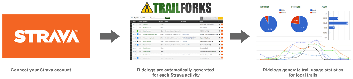
Do you use Strava? If so, we urge you to connect your Strava account with Trailforks. Why you ask?
Trailforks provides you great statistical analysis (more than Strava) including ride history, trails ridden, and year over year data
Trailforks provides us an organization incredible data that we can use to plan future trails, maintain trails, and powerful information to present to local land managers and municipalities